

this is the lower left corner of a world map called the mappa mundi cottoniana, showing northern europe as it was imagined in medieval times.
the images which i’m making accessible here are a selection of world maps (and a few other maps) from the edition of konrad miller (die ältesten weltkarten, stuttgart 1895-1898). the edition is not under copyright any longer and the images are therefore in the public domain. thanks to my brother who helped me out with his photographical skills to bring these maps online!
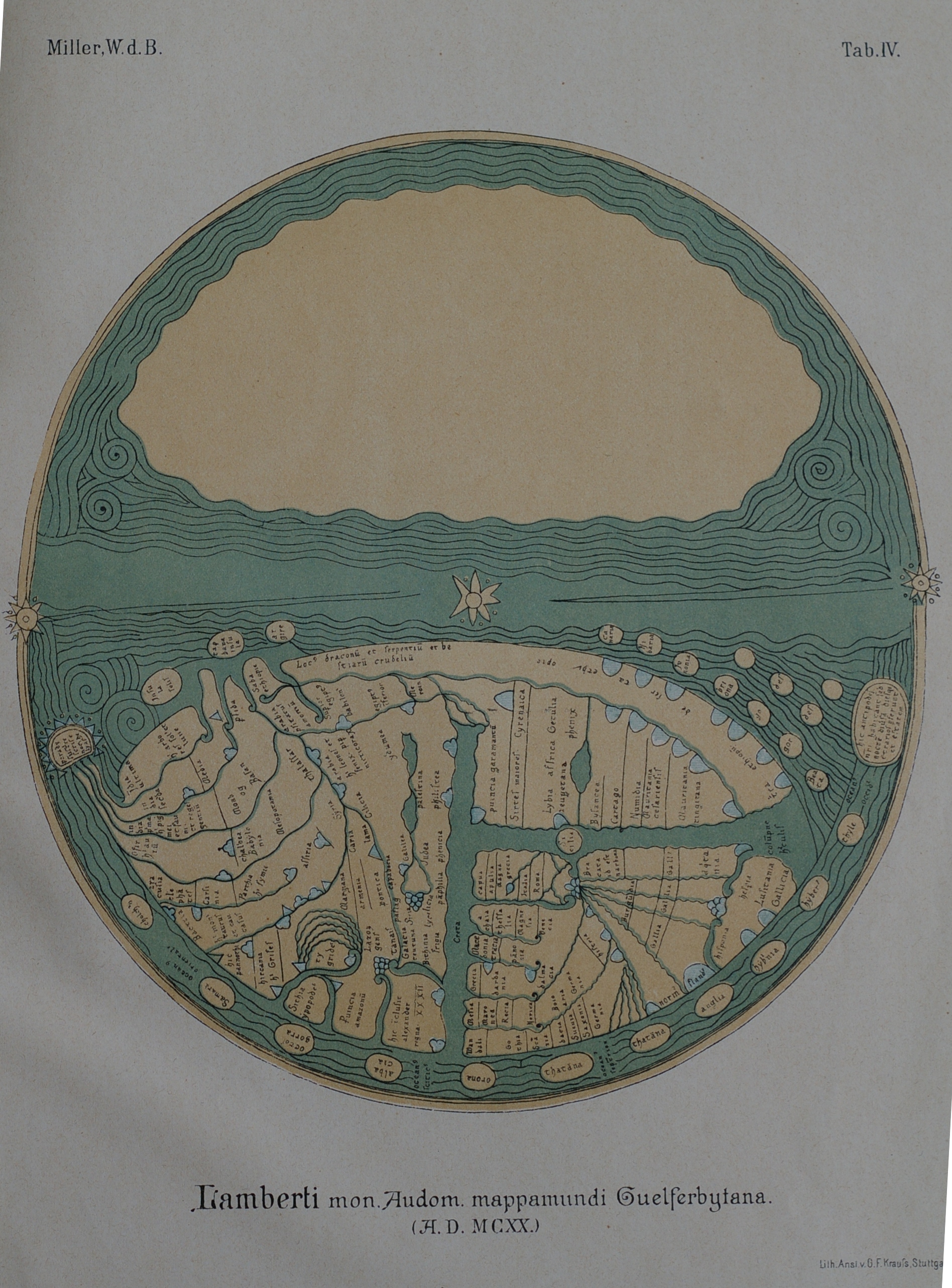
world map of lambert de saint-omer (wolfenbüttel)
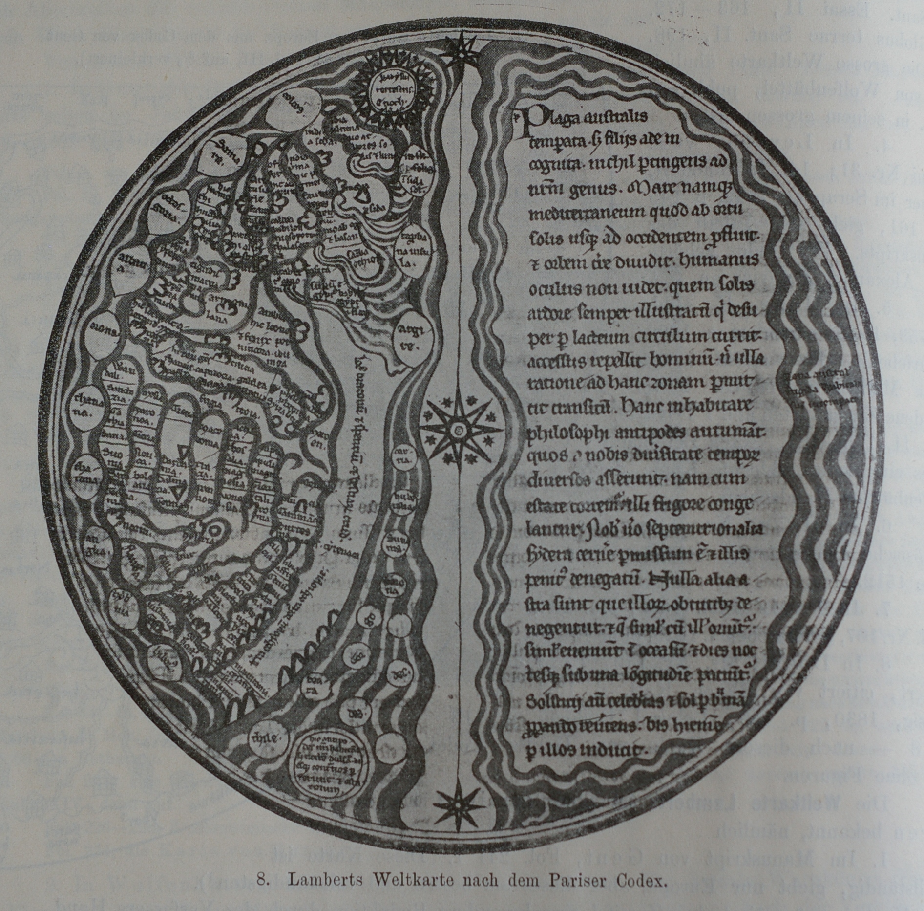
world map of lambert de saint-omer (paris)
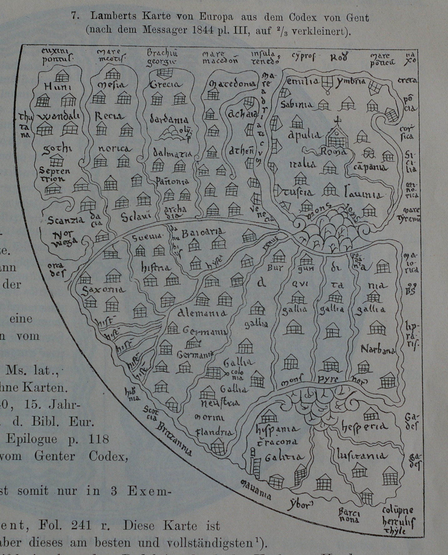
lambert’s map of europe (gent)
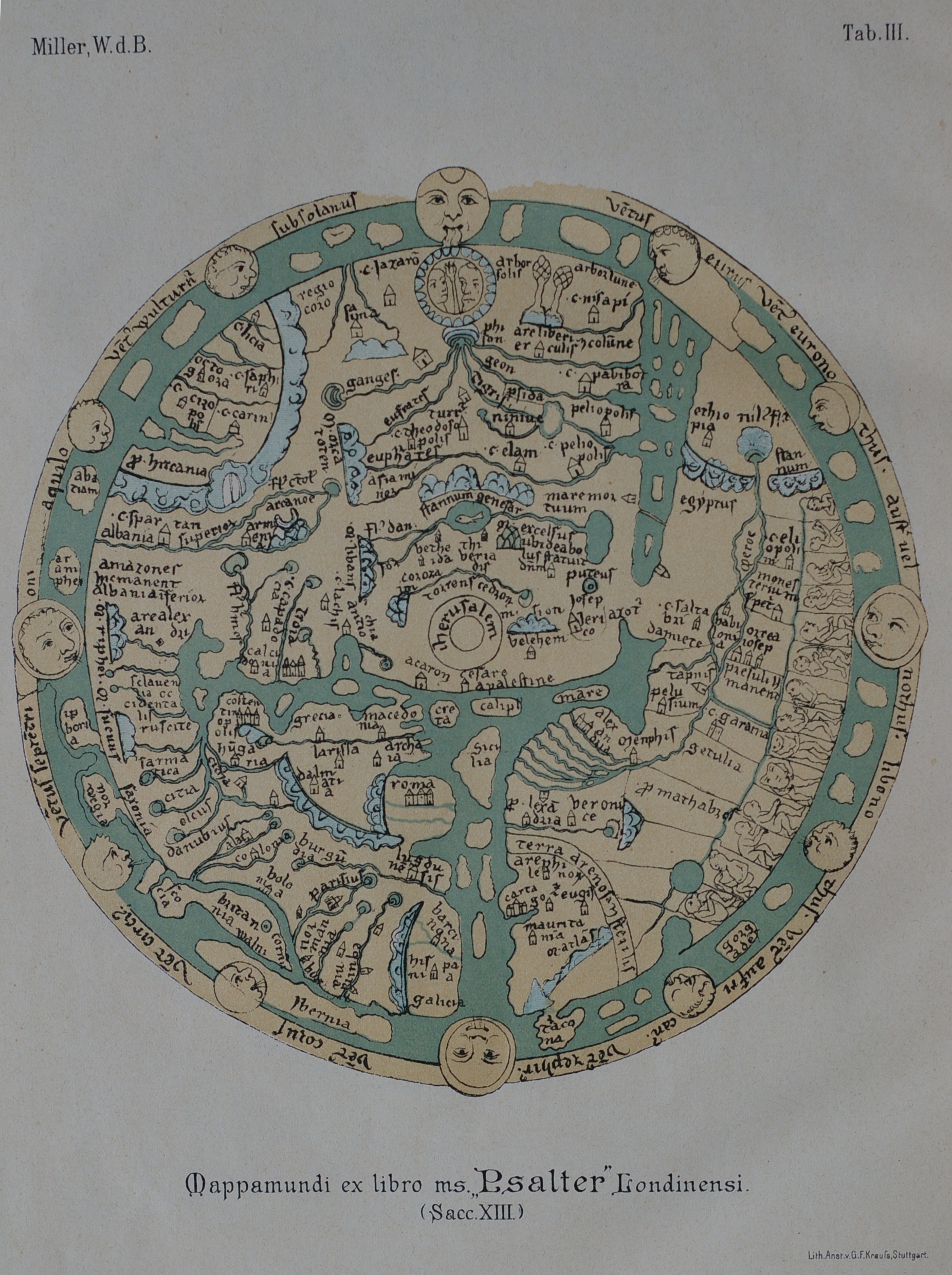
ms psalter londinensi (13th ct.)
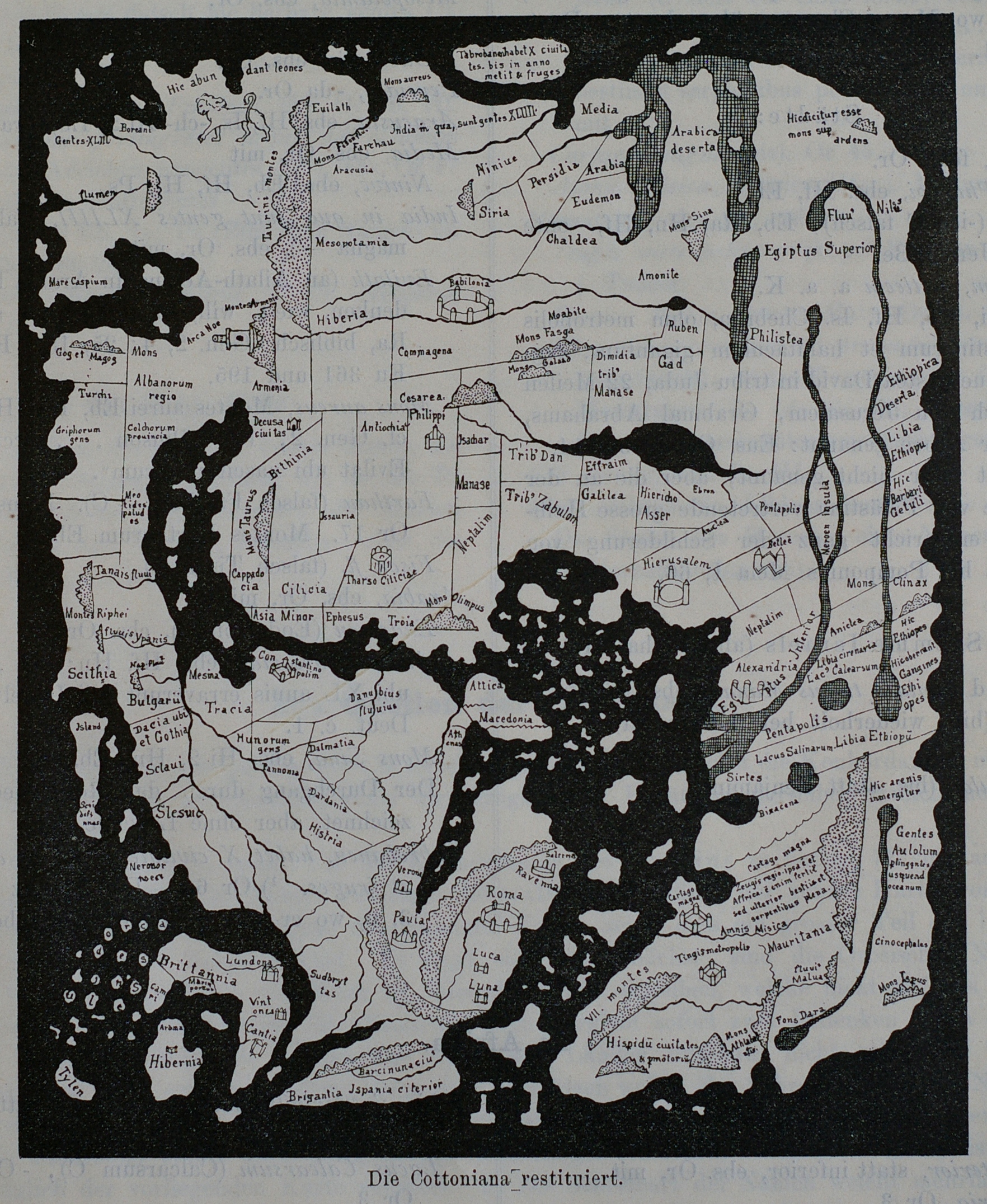
cottoniana (restored)
cottoniana (london; 11th/12th ct.)
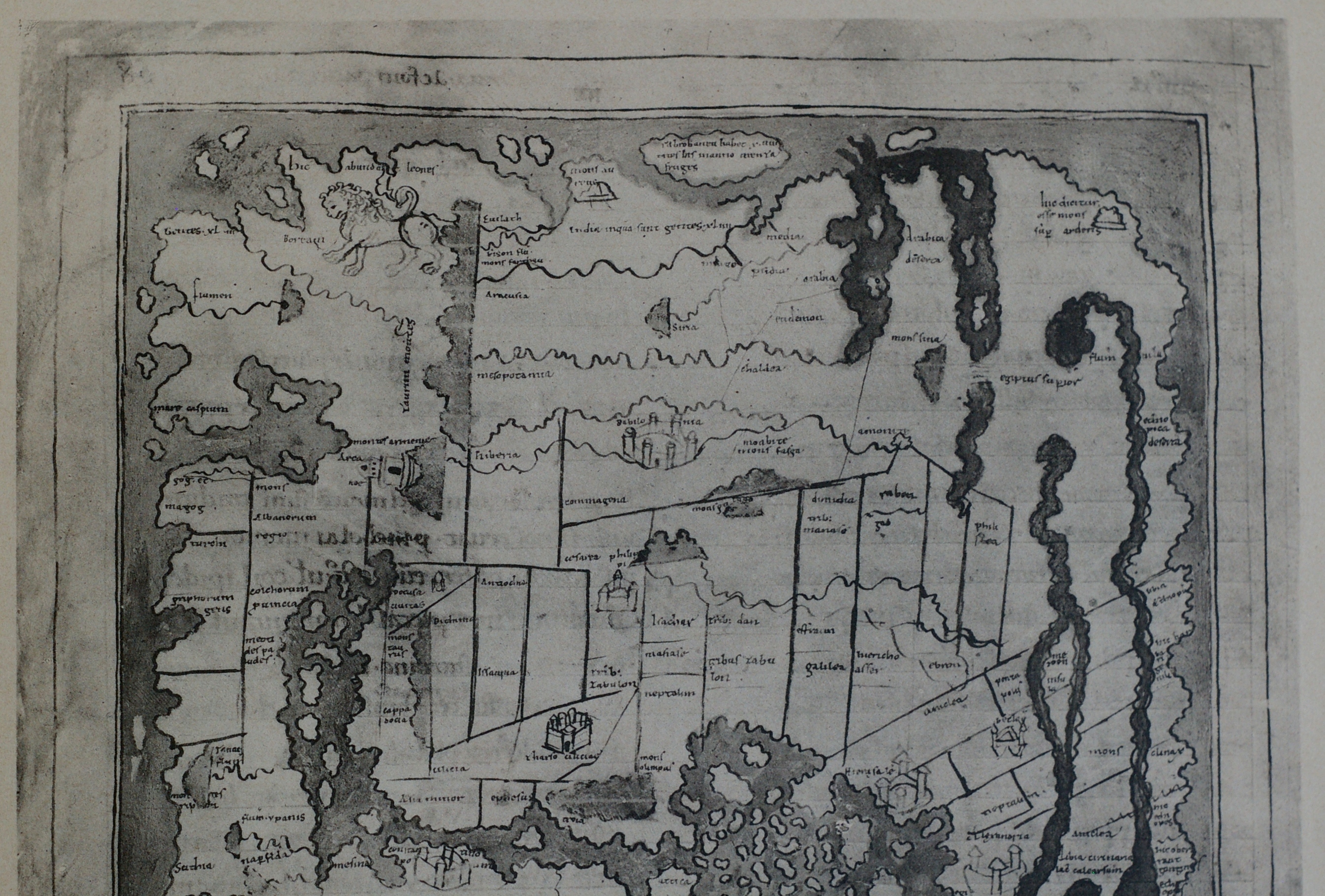
cottoniana, detail (top)
cottoniana, detail (bottom)
map of gaul according to the ravenna cosmography
map of england according to the ravenna cosmography
world map of the ravenna cosmography
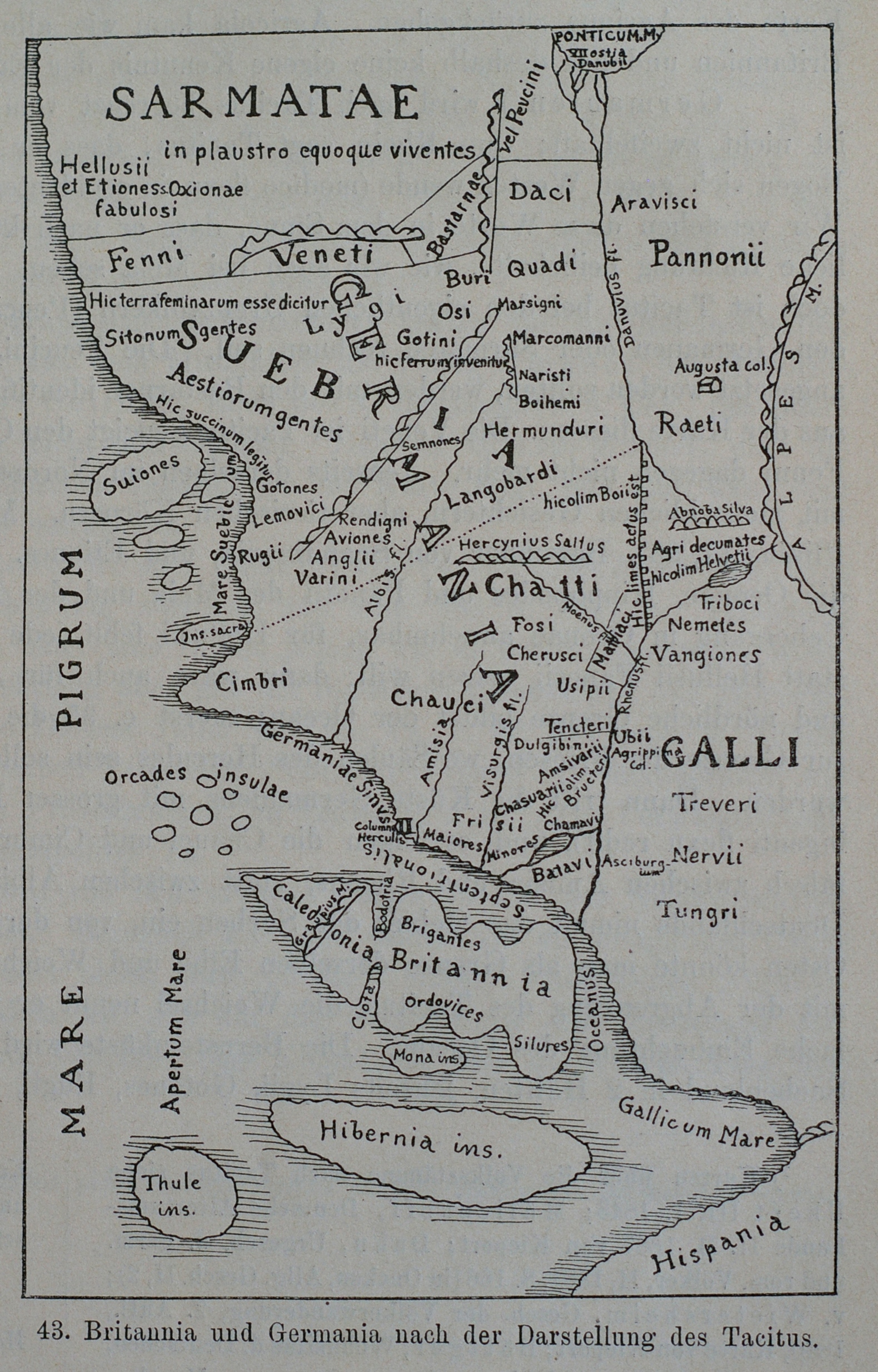
britannia and germania according to tacitus
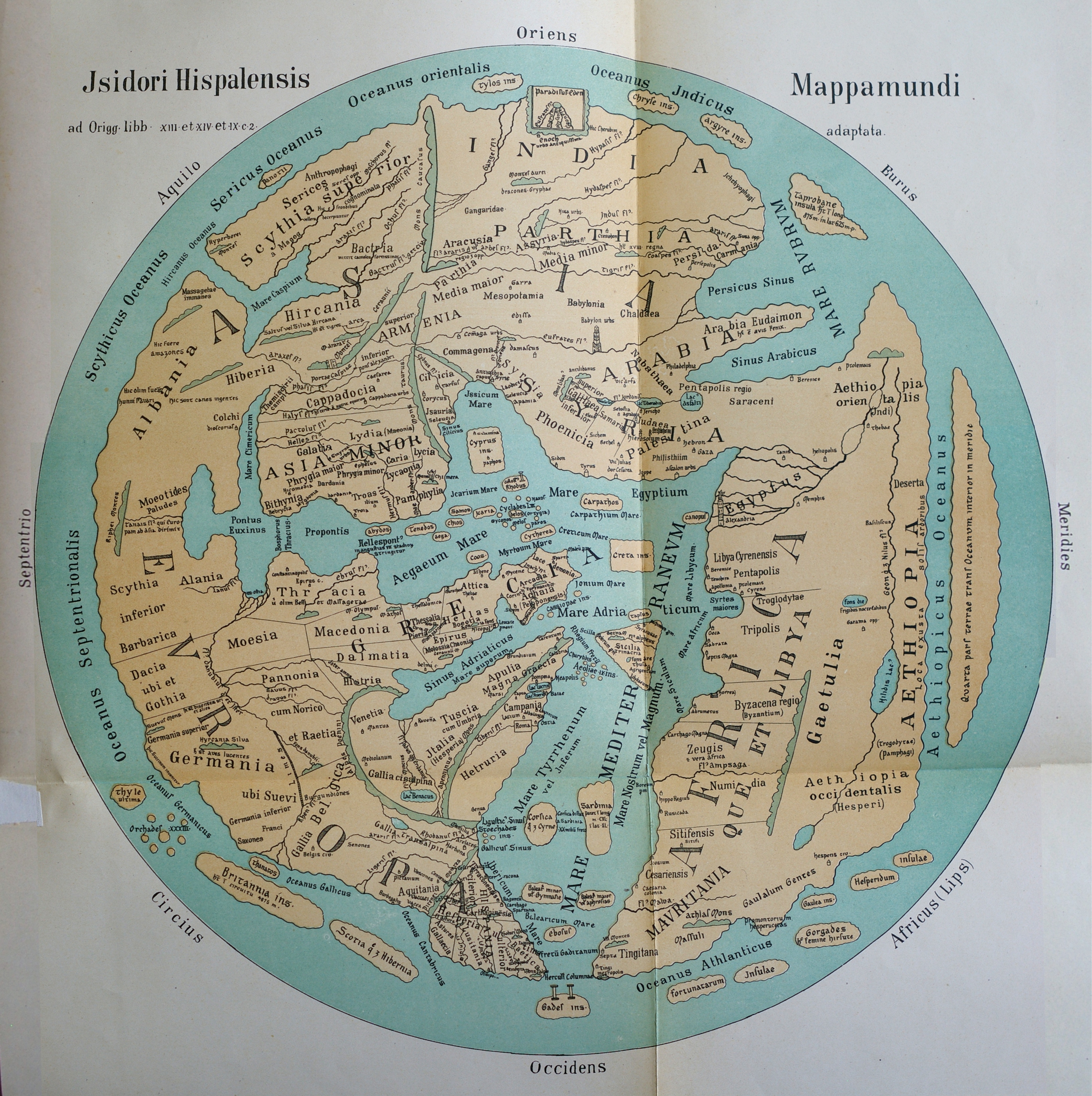
mappamundi jsidori hispalensis
